« Posts by trex

Florence (to) Henderson

Here’s the story of a lovely lady who was…

It’s too early to know if Florence will fulfill her Brady Bunch destiny and pass over Henderson (NC) or not, but any way you slice it, the chances for a potentially crippling natural disaster across central and eastern NC are on the rise.

Ensemble track guidance continues to converge on a solution that would bring Florence ashore between Myrtle Beach and Morehead City.  But remember, it is important not to focus on the singular point that is the center of circulation.  Significant wind damage will radiate out many miles (especially east and north) from the eye.  And while the fact that Florence looks to be at least category 3 and probably 4 at landfall is concerning from a wind standpoint…what happens afterwards with a meandering storm and its torrential rains is potentially more troublesome for a wider region.

So let’s break this down.  Assuming current trends continue we would expect…

  • landfall near the NC/SC as a low end Cat 4 storm (max sustained winds near 140mph) Thursday late afternoon/evening.
  • after landfall, the center of circulation should continue inland toward central NC and toward the VA border, losing forward speed.
  • tropical storm force winds will be felt across the entire state, and hurricane force wind gusts would be realized along and to the east of the track more than 100 miles inland.
  • widespread downed trees and power outages should be expected with the potential that many of those power outages could last a week or more.
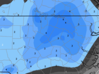
  • without any real steering currents, Florence may meander about NC for a couple of days dumping buckets of rain across eastern NC.  10″ will be common with extremes in excess of two feet, maybe more.

I don’t mean to imply that the above general outline is what everyone will experience.  However, many locations in NC will be affected by these conditions.  Make preparations and alternate plans now so that, dependent on storm track and resultant rainfall maxima, you will be comfortable to ride out the storm, which may last a couple days.

The good news is that we have several days to prepare, continue to monitor track and intensity, and hopefully be able to narrow down exactly where the worst will be as we get to mid-week.


Bust Potential Is High

The current thinking on the weekend wintry weather is that Raleigh will be (slightly) on the warm side of the action.  Could be.  Or not.

Remember when you were a kid playing on the seesaw?  Did you ever play with the kid who was so very close to your weight that you could nearly balance each other?  Didn’t really matter how close, just that he/she had that extra little mass that tipped the seesaw in their favor.  And once tipped, it was all out.  They were on the ground; you were in the air.

And so, this weekend’s setup is a bit of a meteorological seesaw.  The atmosphere is really close to that tipping point where no wintry precip transitions to sleet with heavy wet snow to lots of heavy wet snow…all while surface temps hover just above freezing.

Right now, I’d be on alert for areas north of hwy 64.  This will be one of those situations where the numerical guidance will have a hard time exacting the boundary.  We’ll have to wait until tomorrow evening to really see how this plays out.  The safe bet is that Raleigh just gets a coating of white stuff.  The reality is that Raleigh could get a lot more.  And depending on where that tipping point falls (the gradient will be sharp), we could see a situation where the northern part of the county has significant accumulation, while the southern part is clear.

Let’s figure this out tomorrow!


Palm Sunday Snow?

First off, about the snow for tomorrow (Wednesday)…  it’s not a big deal.  Just like last week wasn’t a big deal.  I don’t generally post unless there will be a significant impact from an event, or i’m intrigued by the possibilities.  So, I’m actually posting now, because I’m intrigued by the potential for a Palm Sunday snow this weekend, and not what will come tomorrow.  It’s a good thing my church is smart and employs a meteorologist to guide them through any meteorological mayhem during the high holy days! 😉

And talk about climatologically unfavorable!  The setup for Sunday is out of the ordinary a) because it’s so late in the season, and b) because of the clipper-like nature of the low diving south of us from the northwest.  We generally don’t get appreciable snows from clipper systems, and many of them go over top of us or to our north, leaving us on the warm side of things.  This could be different.  There is some evidence to suggest that the March Madness that started last weekend with Virginia losing in the NCAA tourney may continue for us with a rare snow.

It’s a hundred years off in meteorologist-time, so a lot can and will change.  But it’s something to watch and see how it develops.

Take Your Mark…

we’re off!

And snow it begins…

Snow is now accumulating over Wake County.  I’m comfortable with last night’s forecast of 7-9″.  However, the latest short term modeling and upstream reports indicate that those numbers may still be too low for western Wake County and back to to Durham/Chapel Hill.  So, we may be looking at 8-10″ with some lucky locales that push a foot.

Enjoy!


To Infinity and Beyond!

…not really, but we need to up these totals.

I understand the need for the NWS and news outlets to be cautious, but all the modeling indicates heavier snow totals in the Triangle and in general across the state.  Ensemble means are running near 5″…impressive.  The latest short term and global American models this evening depict well over 1/2″ of liquid equivalent.  With snow ratios likely to run greater than 10:1, it should be easy to achieve snow totals in excess of 6″.  We shall monitor the overnight runs of the Euro and the short term models.

Bottom line…I’m expecting 7-9″ across the Triangle.  Snow begins early morning (mixed with rain) and really begins to kick around 8 or 9am.  Expect moderate to heavy snow for 6-8 hours, lightening up to spotty snow showers in the evening.

The fun begins soon!


Consensus

Today’s modeling has come into excellent agreement on central NC receiving a significant, moderate snowfall tomorrow.  All the deterministic numerical guidance and their ensemble suites are very similar in depicting an axis of moderate snow accumulations near the Triangle.  Ensemble mean totals are rising, so confidence is pushing even higher for this event.  There will be a broad swath of 1-2″ across the majority the state with the axis of heaviest snows roughly along a line from Southern Pines to Raleigh to South Hill, Virginia.

Questions…how much rain, if any at the onset?  …liquid to snow ratios will be how high?  …where exactly will the favored axis line up?

Expect precipitation in Raleigh to begin as a spotty rain/snow mix as early as 4-5am, but really get going closer to 6 or 7am as moderate to occasionally heavy snow into the afternoon.  I’m expecting 3-5″ in Raleigh.  The over/under on the bust scale is now more like 6″ and 2″.

Enjoy your grocery run!

Upping the Ante

Quick post to say that the overnight models have come in more bullish with the available moisture.  More importantly, they are beginning to agree with each other and converge on a solution that paints the favored axis of heavier snow totals centered a little farther east, closer to the Triangle.  Therefore, I’m willing to raise snow totals a bit in Raleigh…rather than 2″, it’s probably more like 3-4″.  And the over/under bust potential something like 6″ and 1″.

More later…

Another Snowday

Confidence is increasing for snow on Wednesday.

As I said over the weekend, this is not a setup for a lot of snow for us.  And this is not a pattern that NC will typically see a lot of snow.  There is no surface storm (although a low will be forming off the coast with few consequences for NC).  All of the precipitation will be driven by upper level dynamics and frontogenetic forcing.  We have a reinforcing shot of cold air that will arrive overnight Tuesday.  However, ahead of that arctic boundary, temperatures should warm close to 50° tomorrow.  Most modeling indicates that the cold air surging in behind the front will easily overwhelm the warm boundary layer as the moisture arrives.  It’s a tricky situation, though, and I can’t even count the number of busted forecasts where the cold air arrived later than expected and a cold rain dominated before an unsatisfying changeover to snow at the end. #NCMeteorologistRecurringNightmare

So at this point, we shall cautiously proceed with a forecast for Raleigh that looks like:  Mild temperatures Tuesday dropping overnight to near freezing as the precipitation arrives between 7-9am.  Precipitation probably begins as a rain snow mix, but should changeover fairly quickly to all snow.  Accumulation of about 2″ in Raleigh.

Over/Under Bust Potential:  4″ / Dusting

Will update tomorrow with the latest.

Winter Returns and So Does the Snow

If you’re tired of this wet sticky muggy blah of the past couple days, have no fear. Winter returns Sunday with temperatures stuck in the 30s for the first of the week ahead of a reinforcing shot arctic air on tues.  In an atypical setup for NC snow, we’ll look for a wave to setup on the front and spread snow over much of the western 2/3 of the state Wed.  It’s too soon to know details, of course, but something to be aware of for planning.  More details over the weekend…

Better Late Than Never

The Krispy Kreme Challenge has been a mightier task than imagined, but the snow is imminent for Raleigh.  The snow should envelop all of Raleigh by 8:30.

The null between the two areas of precip has come to fruition and so, what could have been, will be less.  Still think that an inch plus is possible given upstream observed accumulations.

Patience young, Padawan!