« Archives in January, 2015

It’s All Over But the Cryin’

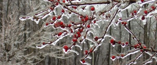
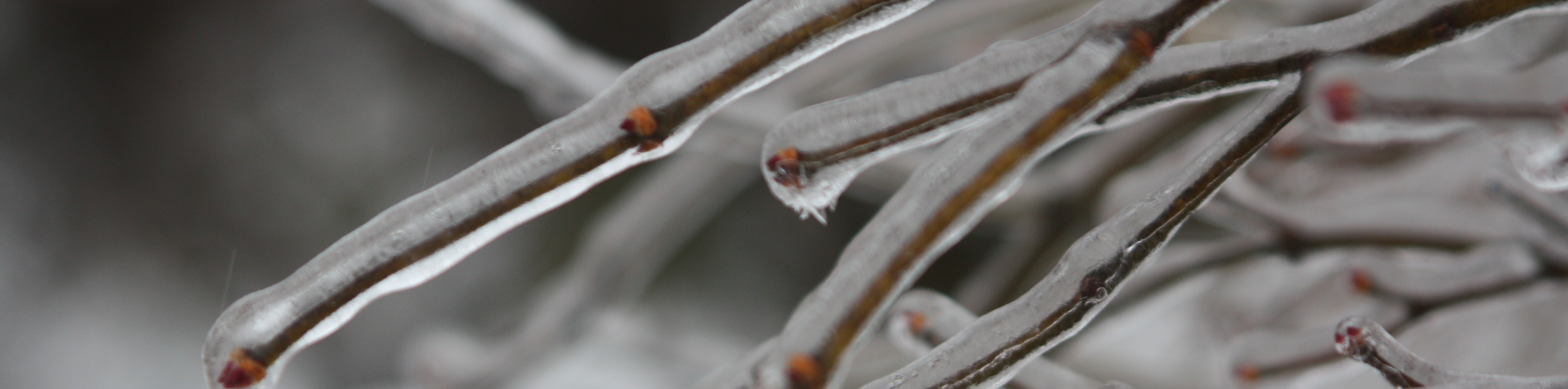
First off, the apology…as advertised from the beginning, the question for this event was to be the precip.  As it turns out, the much bemoaned and berated GFS will win the battle of the small QPF reality.  The primary area of precip is heading off to the northeast toward Norfolk now.  As expected, the max ice accruals will be just north/east of Raleigh.  However the totals across the board will be less than half of what was expected.

Of course, this is all good news from a safety and disruption standpoint…but not so good from a ‘i changed my plans’ perspective.  Again, apologies for my being fooled on this one.

So for the remainder of tonight…the major precip is done.  There will continue to be showers of freezing rain, freezing drizzle and perhaps even some sleet later on as more cold air works in the column.  These showers should prove to be little or no consequence.  So most places near Raleigh should end up with a glaze to a tenth of ice at most.

Looking forward…we’ll have a warm up over the next week before turning back cold end of next week into the last week of Jan.


How Do You Like Your Ice?

…shaved, crushed, cubes?

Everything looks more or less on track.  However, I’m puzzled as to why we’re calling off after school activities today, but I suppose somebody get’s big bucks to make that decision.  As to timing of onset, things in Raleigh shouldn’t begin in earnest until after 10 this evening. There will continue to be a couple of passing showers and areas of drizzle, though. The main precip shield hasn’t even developed yet.  When it does, nowcasting it’s arrival should be much easier.  Then overnight the majority of the precip will fall in the form of freezing rain with some sleet mixing in, especially north.

Icy-Tree1-533x222

And I’m thinking to maybe dial back the ‘sweet spot’ totals I mentioned to up to .4″ with the next band of counties to the west to up to .25″.  These aren’t really material changes in terms of impacts, but I wanted to dial the totals to reflect what’s more likely, rather than what is possible.  Again, once the precip shield develops this evening we should be able to get a good handle on it, as opposed to believing a bunch of 0s and 1s some oversized calculator is crunching.


Significant Icing More Likely

Quick update…

Overnight models have trended wetter with the GFS finally on board.  The new 12 NAM is in and continues bullish for significant event.

Particularly Raleigh and north and east should see the most problems.  Heading towards Durham and west they should have less icing.  The axis of heaviest moisture will be along the I-95 corridor and east.  So there will be the sweet spot of heaviest ice accumulations that balances the cold to the west and moisture to the east.  This looks most likely to be in Wayne, Wilson, Nash and Halifax counties where ice accumulations will be up to .5″.  Then the line of counties the west of that…Harnett, Johnston, Wake, Franklin Warren, Vance should see accumulation up to .3″. Then west of there, up to .1″.

Ice-Storm

Remember that .25″ is a good guideline for when an ice storm becomes bad in terms of downed trees and limbs and widespread power outages.  Further exacerbating this event will be the fact that the ground is very wet from a lot of rain yesterday and even this season.  So we may see more uprooted trees than normal with this storm.

You’ll see the NWS upgrade the winter storm watch to a warning this afternoon.  So, now is a good time to begin making alternate plans for tomorrow.  Also check to make sure you have extra batteries,etc…  Oh and don’t forget to buy lots of bread, milk and beer! 😉

More updates as more model data comes in.

And for more frequent, short updates, follow me on Twitter at trextrex14


Ice Event Wed Morning

It’s been a while since there’s been much to talk about in terms of wintry weather for Raleigh (aside from a quick blast of boo chilly air last week).  So today, in between monsoonal downpours, we are watching the potential for a significant icing event overnight Tuesday thru lunch on Wednesday.

ice tree

A fresh supply of cold air will begin arriving in NC as the rain exits later this evening.  So, the extent of low level cold air supply will not be in question.  The uncertainty will be in how much precip will fall in the Triangle, owing to a weak surface low riding up the coast.  The axis of heaviest precip will certainly lie to the east of Raleigh.  The extent to which it bulges back westward will be the question.

Models differ on this, ranging from just some drizzle and a hundredth or two of liquid equiv, to up to a 1/4″ of liquid equiv (QPF).  At this point, I would expect around a 1/10″ of ice accumulation, which will be enough to make for bad driving and a few problems, but not result in widespread power outages and/or bring lots of tree limbs down.  We’ll watch to see how the numerical guidance trends with QPF over the next day to get a better handle on if this will be just a nuisance event or something to make alternate plans for.

As to timing…It appears that we will be lucky that the freezing rain should begin late Tues evening (10pm to midnight) and continue overnight into Wed AM.  This should help with fewer travel problems, and let people evaluate the conditions Wed AM before venturing out.

More updates later.  But if you would like more frequent updates, follow me on twitter at:  trextrex14