
The current thinking on the weekend wintry weather is that Raleigh will be (slightly) on the warm side of the action. Could be. Or not.
Remember when you were a kid playing on the seesaw? Did you ever play with the kid who was so very close to your weight that you could nearly balance each other? Didn’t really matter how close, just that he/she had that extra little mass that tipped the seesaw in their favor. And once tipped, it was all out. They were on the ground; you were in the air.
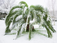
And so, this weekend’s setup is a bit of a meteorological seesaw. The atmosphere is really close to that tipping point where no wintry precip transitions to sleet with heavy wet snow to lots of heavy wet snow…all while surface temps hover just above freezing.
Right now, I’d be on alert for areas north of hwy 64. This will be one of those situations where the numerical guidance will have a hard time exacting the boundary. We’ll have to wait until tomorrow evening to really see how this plays out. The safe bet is that Raleigh just gets a coating of white stuff. The reality is that Raleigh could get a lot more. And depending on where that tipping point falls (the gradient will be sharp), we could see a situation where the northern part of the county has significant accumulation, while the southern part is clear.
Let’s figure this out tomorrow!
Recent Comments