I like my broad brush outline from a couple days ago for Raleigh….
…lots of rain, mixing at times with snow as the day wears on tomorrow. then, finally changes to all snow. The question will be, how much moisture is left when the changeover happens. i.e. how much snow falls at the end?
Additionally, there is thermodynamical cooling to consider with bursts of heavy precipitation as snow melts. Translation…when it snows in an above freezing boundary layer, if it snows hard, then as all those snowflakes melt, they rapidly cool the local atmosphere. This cooling lets the subsequent snow survive all the way to the ground. It can briefly accumulate on the ground and stir folks into a tizzy before the snow melts a little later.
It looks like there will be a fair bit of rain tomorrow morning, then after lunch Raleigh will see periods of rain/snow mix or maybe even a period of snow, but mostly rain until later in the afternoon when snow mixing in becomes favored. Into the evening, snow becomes more likely to the end on Saturday AM. In Raleigh, I think there will be a minor dusting accumulation (an inch would be lucky) on the grass. Nothing on the roads. Travel will not be impacted. North and west of the Raleigh you are more likely to see slightly higher accumulations on the grass, especially later in the evening and Saturday AM.
Let’s nowcast this tomorrow!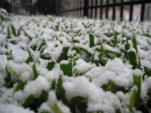

Recent Comments