« Posts under Hurricane

Matthew…so complicated

I suppose it’s time to weigh in on Matthew.

I’ve gotten a lot of emails asking for an update, saying that I’ve been silent.  Not really.  Twitter is a fairly effective tool for quick bursts of info.  And so, I encourage you to follow me there:  @trextrex14

There’s a lot of good information in the media on this storm, so I’ll write this post from the perspective that you’ve heard all of that…and more.  I hope to value add, to give you a couple of considerations in why the forecast could go perfectly as planned, or why it may be a total bust.

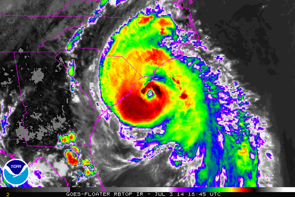
As of midday today, all the numerical guidance seemed to be converging to a tidy solution (albeit problematic in itself…for reasons I’ll talk about next).  That solution had the track of Matthew basically mirroring the concave SE coastline from FL thru GA and SC to NC then curving out to sea.  In this scenario, Matthew would track just offshore, pounding the coastline from FL to NC.  The problematic part of this is that since the shape of the coastline and the track would be nearly the same.  Any deviation of the track to the left would push the hurricane inland and significantly weaken Matthew for all locales north, i.e. less wind and surge, but still decent wind and lots of rain.  So that’s what’s hard if there was just that.

However, the Euro came in this afternoon with a literal curveball.  It depicted Matthew grazing the FL coast before doing a loop off GA back toward FL.  Then a couple of the Euro ensemble members had loops, and several had a hard right turn near GA.  Then the 18Z American ensembles came in continuing this new idea of out to sea and not up the coast.  Now, hot off the presses, the 0Z dynamical guidance echoes a similar theme…out to sea.

So, at this point I would like to be able to tell you there is confidence in a solution.  Tonight, there is more uncertainty than ever.  Hold tight, make plans for how to be prepared, but I would say there’s no need to act upon them until we see more data.  Remember we still have more than 3 days to work this out.


Is the Euro right? Oui! (well, maybe)

It’s too early to say for certain…but could it be that the Europeans will win yet another meteorological face-off over the battle-scarred Americans?  This would, in fact, be great news for NC to have an out-to-sea ‘fish’ storm.

Here’s a beautiful picture of Joaquin whose official max winds are recorded at 125mph.  One more tick up on the wind speed will put it at Cat 4 status.  Joaquin continues drifting SW around the Bahamas and will not make a definitive turn to the north until tomorrow.  And once that turns happens, it should remove some of the uncertainty that still exists.
CQPP7hyWwAApjd8.jpg-large

The model spread is troubling.  Many of last evening’s 0Z runs shifted their forecast tracks eastward (right) with the Euro holding firm to it’s out-to-sea solution.  Interestingly, the US NAM, which was a lone ally of the Euro, flipped to the western (left) solution.  Not that I trust the NAM…I can hardly find 5 or 6 good words to say about it, but it is interesting, nonetheless. The bottom line is that no one can say with certainty what the track will be at this time, but by tomorrow morning we should have a better grip on this.  Let’s see who is right…or left…or correct 😉

I opened with the wildcard of Joaquin, because if it comes it will make an impending bad situation, devastating.  So, it’s important to emphasize, no matter what happens to Joaquin, heavy rainfall tonight thru Sunday will cause widespread flooding in NC and SC.  There will be general precip totals of 3-5″ for everyone, however there will also be an axis of training moisture that drops double to triple those amounts.  Indications now are that this band will setup up near the NC/SC border or just into SC.  In that scenario, the Triangle is spared the worst.

Obviously, lots of moving parts and things to keep an eye on.  It’s time for the new GFS to come in.  Let’s see if we stay consist or we flip.

Bon chance mes amis!

Potential for Widespread Flooding and a NC Landfall of Joaquin

I’m fielding a lot of questions about the complicated and serious threat of flooding this weekend.  I thought I would do a quick post now to address a couple issues before a more comprehensive post later today.

There are two separate (but related) issues to deal with:

1) an inverted trough that will act as a focusing mechanism for deep moisture transport and heavy rains through the Carolinas.

2) Joaquin and it’s eventual track that with the potential for landfall in NC or VA

The heavy rains come first regardless of the what Joaquin does.  And the impact of these heavy rains looks to be widespread flooding over the Carolinas.

This afternoon Joaquin continues to steadily strengthen…winds up to 85mph, pressure down to 968mb.  It’s meandering in the eastern Bahamas now and is expected to be dragged north and west over the next couples days.  Will it remain offshore as earlier depicted in the modeling? or will it make that turn to the left (west) into NC or VA, as is the trend with a lot of the numerical guidance today?

More complete discuss later.  For now, begin to think ahead as to any preparations you might need to make, especially in areas prone to flooding.

When You Get Caught Between Lejeune and Morehead City

Ok, Arthur may have altered the lyrics today for landfall tonight. 😉  (I should clarify that I don’t think it will be as far west as Camp Lejeune, but it made the rhyme work for the song)

The latest 18Z models definitely shift the entire guidance envelope to the west…making a track inside of HAT seem like the likely scenario now.  And the 12Z Euro agrees.  Again this is important because where the eye passes and to the east will be the worst of the storm.  This track puts most of the OBX on the ‘wrong’ side of the path and increases the chances for more damage.  It also puts the popular NC beaches…Emerald Isle, Salter Path and Atlantic at higher risk for a direct hit.

There are lots of emergency preparations going on at the coast now.  In Hyde Co. they mean business…alcohol sales have been suspended!  I bet there’s a black market formed already!

But seriously, the satellite presentation has improved this afternoon with ragged eye emerging.

BrpFYEyCMAAXW-e

We can expect a little more strengthening before landfall later tonight.  Latest pressure is 977mb.  I am comfortable with my call last night…landfall close to Beaufort with max sustained winds of 100-105 mph east of the center.  Remember the good part of this storm is how quickly it will be out of here.  Stay safe if you’re at the beach!


When You Get Caught Between the Moon and NYC…

Ok, who gets the title reference?  If you don’t, go look it up…

I’ve tried to avoid posting on Arthur for the last couple days as it looked like he would head over or east of HAT.  Now that Arthur has actually formed and has a definable track northward, things are looking a little more interesting for the possibility of a landfall west and south of the OBX.

Geography reminder…NC juts out quite a bit east from the southeastern coast.  So it’s with good reason that we have a hockey team called the Hurricanes!  The geography makes NC climatologically favored to landfall hurricanes.  The question tonight really is…does the eye pass over HAT or is it farther west.  And when we talk about the center coming farther west, a small westward shift implies huge differences in impacts (again, geography).

Keep in mind that the most pronounced impact will be felt on the northeast side of the eye.  So…a 50 mile westward shift is the difference between landfalling at HAT with just water and fish to the east (bad for them, but good for everyone else) and landfalling at Beaufort with all of the OBX to the east to get the worst.  A 75 mile westward shift puts Arthur landfalling at Emerald Isle.  And a 125 mile westward shift landfalls Arthur in Wilmington.

This evening’s model runs have shifted a bit westward, but it’s imprudent to completely bite on that yet, especially without yet having seen the Euro, which has been on top of this for the past week.

Final word… The trend is for a larger portion of the coast to be affected than previously thought.  This will be a significant storm, but not a major storm for those along and east of the eye.  Best guess at this point would be for a landfall just east of Beaufort (near Cape Lookout) early Friday morning with max winds at 100mph…solid Cat 2.  The good news is that regardless of landfall and intensity…it will be short-lived as the storm will be accelerated to the northeast ahead of a cold front that will usher in springlike weather for the holiday weekend for much of NC.