When You Get Caught Between the Moon and NYC…

Ok, who gets the title reference?  If you don’t, go look it up…

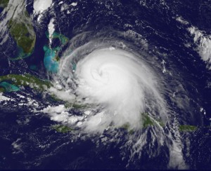
I’ve tried to avoid posting on Arthur for the last couple days as it looked like he would head over or east of HAT.  Now that Arthur has actually formed and has a definable track northward, things are looking a little more interesting for the possibility of a landfall west and south of the OBX.

Geography reminder…NC juts out quite a bit east from the southeastern coast.  So it’s with good reason that we have a hockey team called the Hurricanes!  The geography makes NC climatologically favored to landfall hurricanes.  The question tonight really is…does the eye pass over HAT or is it farther west.  And when we talk about the center coming farther west, a small westward shift implies huge differences in impacts (again, geography).

Keep in mind that the most pronounced impact will be felt on the northeast side of the eye.  So…a 50 mile westward shift is the difference between landfalling at HAT with just water and fish to the east (bad for them, but good for everyone else) and landfalling at Beaufort with all of the OBX to the east to get the worst.  A 75 mile westward shift puts Arthur landfalling at Emerald Isle.  And a 125 mile westward shift landfalls Arthur in Wilmington.

This evening’s model runs have shifted a bit westward, but it’s imprudent to completely bite on that yet, especially without yet having seen the Euro, which has been on top of this for the past week.

Final word… The trend is for a larger portion of the coast to be affected than previously thought.  This will be a significant storm, but not a major storm for those along and east of the eye.  Best guess at this point would be for a landfall just east of Beaufort (near Cape Lookout) early Friday morning with max winds at 100mph…solid Cat 2.  The good news is that regardless of landfall and intensity…it will be short-lived as the storm will be accelerated to the northeast ahead of a cold front that will usher in springlike weather for the holiday weekend for much of NC.


Yes, It Will Snow…

…but rain is the more likely p-type.

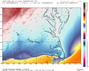
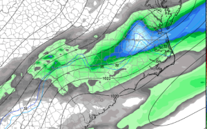
With boundary layer temperatures several degrees above freezing, it will take heavier bouts of precip to drive any mix with or change to snow.  And while the axis of heavier moisture looks confined east of I-95, it wouldn’t take much to back it into Raleigh as the coastal low develops off Hatteras.

So, I’ll stick with cold rain, sometimes mixed with snow, and probably even a shower where it’s all snow for a while…but not enough to accumulate on any roads…lucky to accumulate on elevated surfaces north of the Triangle.  All this with the caveat to that everything evolves with the deep moisture to the east.  We’ll monitor and see.

That’s for us.  But more exciting will be to watch this storm bomb out up the coast with hurricane forces winds on Cape Cod.

Bullet Dodged?

As to the question of “To Sea or Not to Sea?”… I think we still have to wait and “see”.  No doubt, the majority of the modeling indicates that the eventual explosive cyclogenesis should take place offshore far enough preclude an I-95 corridor blizzard.  However, there are some things that just don’t seem right to me.

Anytime we have coastal cyclogenesis the uncertainty level is heightened.  In this case, multiple different shortwaves will interact and incite two surface lows off the East Coast.  The various models differ on where each of these lows form and how they track north.  What is unifying in the solutions is that one low cannibalizes the other as it bombs out heading for Nova Scotia.  In many of the simulations the more south and east low predominates and much of the energy is pulled east.  In the latest, Euro there’s even a Fujiwhara-like tango of the two low centers…dancing lowsIt seems weird to me that the more western low would lose out to the eastern low, especially since the western low should be fed by the warm Gulf Stream.  See the current SST (sea surface temperature) anomalies…

SST anomalies

By now you’re probably bored and want me to cut to the chase as to what this means for NC, so I’ll oblige… I don’t know.  Just picking.  Kind of…

For clarification of time…this will be Tues AM.  Following the party line would be to say that development of a coastal low will confine the deepest moisture and precip totals east of Raleigh.  And without sufficient precip, it will be tough to cool the boundary layer to near freezing.  That means that there should be a cold rain mixed with snow, especially in relatively heavier showers of precip.  But we’re only talking .1″ of liquid equivalent, so not much of anything.  Heavier precip amounts will be found farther east to the coast.  In the northeast part of NC into eastern VA is where there could be more snow mixed in.

All this is based on the low developing sufficiently offshore, a westward jaunt of 100 miles would mean heavier precip rates and more heavy wet snow into Raleigh.  Perhaps I’m being foolish about this, but I want to see more agreement in the modeling before I pronounce this scenario off the table.

If you’re traveling north this week.  Boston and Cape Cod look to get clocked.  Again I want to see how this dueling low thing plays out and which dominates, but under the western-dominant low idea we would see lots of snow back into Long Island and double digit totals even into NYC with several inches back to Philly and tapering back south and west.

Lots of time yet to fret!

To Sea or Not to Sea…

…that is the question.

Like I said yesterday, we’re in that mid-game time when a track out to sea comes into play.  Certainly the 12Z runs of pretty much all of the models have shifted east.  The other trend this go round has been to rapidly deepen the low (bomb it out) as it races north, which is also something we were looking for.

There is good consensus on the potential for a very powerful Nor’easter with pressures nearing 960mb (that’s low…’Superstorm Sandy made landfall in Jersey with a pressure of 946mb).  Of course, this will happen when it bombs out off the New England coast.  The question is, what does the track look like.  And we won’t really be able to say with any confidence until the energy (that thousands of miles away and will eventually grow to be the storm) is sampled by upper air observations on Saturday.  Once those observations are integrated into the models, then things will become more clear.

For you snow lovers, don’t take this as the kiss of death, because it certainly is not. And, in fact, this AM’s GFS still depicted several inches of snow for central and eastern NC.

Bottom line is that tonight’s models won’t interest me as much as those beginning tomorrow AM, but especially into Sunday.

Chances Increasing for Significant Storm

There is remarkable agreement among the various models as to a significant coastal winter storm next Tues and Wed that will affect the Carolinas thru the Mid-Atlantic and perhaps southern New England.  But it’s about that time in the mid-range where many times the models “lose” the storm altogether or usher it out to sea for a couple of model cycles.  It’ll be interesting to see if that happens.

But at this point, both the operational and control runs, as well as most of the ensemble members, show a late-season winter storm that looks to add enough snow to break all-time snow totals for the month of March in the Mid-Atlantic.

Standard NC winter weather caveats apply…much can change in several days and a storm like this is definitely climatologically unfavorable.  But…all other signs are pointing to just the right ingredients coming together.

Finally, as I said in the last post, the last time Raleigh had a major snow this late in the season was 7.3″ in 1983.  As I recall, it was a time of Cinderellas, if you know what I mean.  And maybe, just maybe…tonight another red team hops a ride on the pumpkin coach!

Late Season Snowmongering

What’s today?  Is it March 15th? Oh no, it’s not…it must be the Ice of March.  r r r

I mentioned yesterday that the cold will return early next week…and now I’d like to mention that next Tuesday we’re in the running for another late season snowstorm.  Ironically, it was on March 24th of 1983 that RDU recorded it’s biggest snowfall so late in the season.  And there are several instances of late season snows clustered in the March 24-27th range over the years (with 1983 being the biggest at 7.3″).  And if you’re curious, the latest measurable snow of the season at RDU was April 18th with a little under 2″.

Of course, nothing is set in stone for early next week.  At this point,  the cold looks to return and there is ensemble modeling support for costal cyclogenesis.  The details will come into focus in the coming days.

Here It Comes

The NWS is issuing an advisory in this next update package that will run thru tomorrow AM for most of the area.  We will continue to see a mixed bag of wintry precip thru the evening and overnight on a showery basis.  In general, the harder it precips the more likely you would be to see snow or sleet vs. freezing rain or drizzle. For most, this will just be a nuisance event with minor ice accrual in the trees and elevated surfaces.  Ground temps are still way warm, so accumulation there will be difficult except under heavier bursts of sleet, which are possible, but won’t be widespread.  The fly in the ointment would be if areas like Wake Co. held on to substantial precip for longer, in which case things might be a little worse than expected.  You see, the axis of heaviest precip overnight and into tomorrow AM will be east and toward the costal plain. We’ll see how it plays out.

The winter that won’t die…

…and speaking of winter continuing, there’s another cold shot coming for the latter half of the weekend into next week 😉

Wintry Mix

Temps are locked-in near and below freezing with the cold air dammed east of the mountains.  We talked about a lull in the precip that we would have this AM, and that the question would be how much precip occurred after the lull with the cold air in place.  So at midday, we’re seeing the radar fill back in and precip advancing from north and east from the south and west.  The NWS has expanded the advisory to include Durham and Orange counties, and I expect that here in Wake Co. we will also begin to see some sleet and freezing rain as the afternoon wears on such that an advisory may also be needed later.  Precip should begin in Durham around 1pm and head east into Raleigh between 1:30 and 2pm.

Ok, Not a White Shamrock, Maybe a Glistening Crystalline Shamrock

I need to do some research to look back and see the last time Raleigh had an ice storm this late in the season.  A couple inches of snow is easier to achieve than a prolonged subfreezing ice event (because you can get a couple inches of snow. it lays.  it’s pretty. and then it melts several hours later or the next day.)

As I seem to say with every event…it’s a complicated setup…and still much discrepancy in the modeling.  Actually, this looks to be a one-two punch.  Tomorrow afternoon we begin with moderate to heavy soaking rains on top of already saturated soils and streams overnight (some minor river flooding).  And cold air begins to ooze in late from an advancing Canadian airmass (eh!).  The colder air begins to arrive as the heaviest axis of moisture from the first round exits.  We’re left in a relative minimum of light precip going into Monday AM and thru the day Monday.  However, there looks to be enough cold air and moisture to combine for a little freezing rain as we hover just at freezing (more moisture than progged would be bad.)  Then the timing of a secondary low riding up the coast as the near freezing temps are in place comes into question.  It looks like moisture will arrive overnight Monday into Tuesday AM to cause more significant freezing rain before the self-limiting physics of freezing rain warms the area (SE to NW) enough on Tuesday to turn everything to rain.

So what does it mean?  Bad or no?  2-3 days out in the middle of March…I’m inclined to err on the side conservative climatology, which casts a large cloud of skepticism on the likelihood of a significant impact for the Triangle.  For now let’s wait and see more data…which will probably only find us agonizing over the same questions two days from now!

Line of T-Storms to Impact Triangle this Eve

A developing line of thunderstorms is moving east out of the Triad, where the airport in Greensboro just reported a wind gust of 61 mph.  It depends on just where you fall in the line as to the impact that your backyard will receive.  It’s blue skies now, but the storms will roll into the Triangle near 7 and after.  Heads up!