« Archives in January, 2018

Take Your Mark…

we’re off!

And snow it begins…

Snow is now accumulating over Wake County.  I’m comfortable with last night’s forecast of 7-9″.  However, the latest short term modeling and upstream reports indicate that those numbers may still be too low for western Wake County and back to to Durham/Chapel Hill.  So, we may be looking at 8-10″ with some lucky locales that push a foot.

Enjoy!


To Infinity and Beyond!

…not really, but we need to up these totals.

I understand the need for the NWS and news outlets to be cautious, but all the modeling indicates heavier snow totals in the Triangle and in general across the state.  Ensemble means are running near 5″…impressive.  The latest short term and global American models this evening depict well over 1/2″ of liquid equivalent.  With snow ratios likely to run greater than 10:1, it should be easy to achieve snow totals in excess of 6″.  We shall monitor the overnight runs of the Euro and the short term models.

Bottom line…I’m expecting 7-9″ across the Triangle.  Snow begins early morning (mixed with rain) and really begins to kick around 8 or 9am.  Expect moderate to heavy snow for 6-8 hours, lightening up to spotty snow showers in the evening.

The fun begins soon!


Consensus

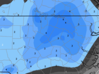
Today’s modeling has come into excellent agreement on central NC receiving a significant, moderate snowfall tomorrow.  All the deterministic numerical guidance and their ensemble suites are very similar in depicting an axis of moderate snow accumulations near the Triangle.  Ensemble mean totals are rising, so confidence is pushing even higher for this event.  There will be a broad swath of 1-2″ across the majority the state with the axis of heaviest snows roughly along a line from Southern Pines to Raleigh to South Hill, Virginia.

Questions…how much rain, if any at the onset?  …liquid to snow ratios will be how high?  …where exactly will the favored axis line up?

Expect precipitation in Raleigh to begin as a spotty rain/snow mix as early as 4-5am, but really get going closer to 6 or 7am as moderate to occasionally heavy snow into the afternoon.  I’m expecting 3-5″ in Raleigh.  The over/under on the bust scale is now more like 6″ and 2″.

Enjoy your grocery run!

Upping the Ante

Quick post to say that the overnight models have come in more bullish with the available moisture.  More importantly, they are beginning to agree with each other and converge on a solution that paints the favored axis of heavier snow totals centered a little farther east, closer to the Triangle.  Therefore, I’m willing to raise snow totals a bit in Raleigh…rather than 2″, it’s probably more like 3-4″.  And the over/under bust potential something like 6″ and 1″.

More later…

Another Snowday

Confidence is increasing for snow on Wednesday.

As I said over the weekend, this is not a setup for a lot of snow for us.  And this is not a pattern that NC will typically see a lot of snow.  There is no surface storm (although a low will be forming off the coast with few consequences for NC).  All of the precipitation will be driven by upper level dynamics and frontogenetic forcing.  We have a reinforcing shot of cold air that will arrive overnight Tuesday.  However, ahead of that arctic boundary, temperatures should warm close to 50° tomorrow.  Most modeling indicates that the cold air surging in behind the front will easily overwhelm the warm boundary layer as the moisture arrives.  It’s a tricky situation, though, and I can’t even count the number of busted forecasts where the cold air arrived later than expected and a cold rain dominated before an unsatisfying changeover to snow at the end. #NCMeteorologistRecurringNightmare

So at this point, we shall cautiously proceed with a forecast for Raleigh that looks like:  Mild temperatures Tuesday dropping overnight to near freezing as the precipitation arrives between 7-9am.  Precipitation probably begins as a rain snow mix, but should changeover fairly quickly to all snow.  Accumulation of about 2″ in Raleigh.

Over/Under Bust Potential:  4″ / Dusting

Will update tomorrow with the latest.

Winter Returns and So Does the Snow

If you’re tired of this wet sticky muggy blah of the past couple days, have no fear. Winter returns Sunday with temperatures stuck in the 30s for the first of the week ahead of a reinforcing shot arctic air on tues.  In an atypical setup for NC snow, we’ll look for a wave to setup on the front and spread snow over much of the western 2/3 of the state Wed.  It’s too soon to know details, of course, but something to be aware of for planning.  More details over the weekend…

Better Late Than Never

The Krispy Kreme Challenge has been a mightier task than imagined, but the snow is imminent for Raleigh.  The snow should envelop all of Raleigh by 8:30.

The null between the two areas of precip has come to fruition and so, what could have been, will be less.  Still think that an inch plus is possible given upstream observed accumulations.

Patience young, Padawan!


Feeling Like a Krispy Kreme?


Snow, snow all around…

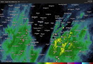
Filling in to the west, filling in to the east. Raleigh left in the doughnut hole.

Should begin to snow in the Triangle over the next hour or so and then we’ll see how long the precip lasts…cutting off in Raleigh before midnight.

Hopefully we can achieve that inch or two!

Again, be safe and take it slow as just a little snow on these cold roads will make driving tricky.


Monkey in the Middle?

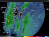
As we’re about to get the party started, wintry precip is breaking out all over the deep south coastal areas.

The short term modeling is now suggesting that the inland precip shield may dissipate in favor of the precip band on the western edge of the bombing offshore cyclone.  Meaning that the snow moving northward thru GA and SC might begin to dissipate as is moves into the southern Piedmont of NC as moisture and energy is transferred to the developing precip band directly associated with the rapidly deepening storm.  So, there could be a relative minimum between these two, which would leave Wake Co as the monkey in the middle.  This, as opposed to that band coming out of SC holding together a little farther north, while the eastern band forms just a little farther west.

Still too early to make any major pronouncements, as it’s a developing situation…literally.  Greenville to Norfolk still looks to be the sweet spot.  But for Wake Co., probably more like a dusting to an inch, with those higher total scenarios, while not off the table, certainly looking more sketchy.  Remember, though, that the ground is very cold and just a little snow will go a long way in making travel slick very quickly.


The Trend Is Your Friend

…but do we have a trend?

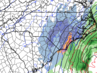
This afternoon’s Euro shifted the storm track significantly westward, and closer to the NAM 3km.  One run doth not make a trend, so we wait to see what the next cycle shows.  NC probably gets most of its moisture rung out as snow from confluence forced by an inverted trough and costal baroclinic zone to the west of the eventual storm track.  It’s a highly dynamic system that will lead to a spectacular storm.  And the questions remain just where all these fireworks take place from the novel winter storm in the FL Panhandle northward to most all areas along the Eastern Seaboard.

For NC you’ve got two things going on: 1) moisture coming together ahead of the storm that will produce light to moderate snow in the eastern 1/3 of the state, and 2) the storm system really beginning to bomb out as it approaches NC’s latitude on it’s race northward to Newfoundland.  The extent to which rapid cyclogenesis occurs, how close the low is to the coast and what the precipitation shield looks like will all dictate how much bonus snow eastern NC will tally.  If the low tracks a little farther west under more influence of the coastal trough, then NC snow totals will edge higher.  Obviously, the opposite is also a viable option, resulting in just light accumulations.

I hesitate to throw around things like the Jan 2000 storm, but there are some similarities.  Again, it’s a highly dynamic situation and in these situations it’s best to see how the precipitation begins to blossom in the early stages before we write off one solution or another as implausible.

To summarize…this will be a storm where the accumulation gradient lines up mostly WSW  to ENE… i.e. this is not a Roxboro gets all the snow where everybody south gets nothing.  Highest snow totals should be found in northeastern NC.  My best estimate is that Wake county will see 1″ near the airport, ramping up to 2-3″ at the JoCo border.  Higher totals will be eastward in a band from say Greenville to Norfolk where they could be looking at 3-6″, possibly more.  Snow begins tomorrow afternoon.

Finally, need I remind you that it’s cold?!  And any snow on the ground will only make it colder.  Also, the breezy conditions behind the storm will make the cold bite even more.  Be prepared.

Update:  most 18Z guidance came in wetter and farther west.  we shall see if this is a trend.  if so, totals my be increased a category.