
To quote my last post on Jan 3rd… “late Friday/Saturday (Jan 10/11). Things look intriguing.”
The good news for winter weather lovers is that things continue to look intriguing. And while this setup will go down as a wasted opportunity for a major storm, NC still looks to be squarely in focus for a widespread winter weather event with significant impacts across the state.
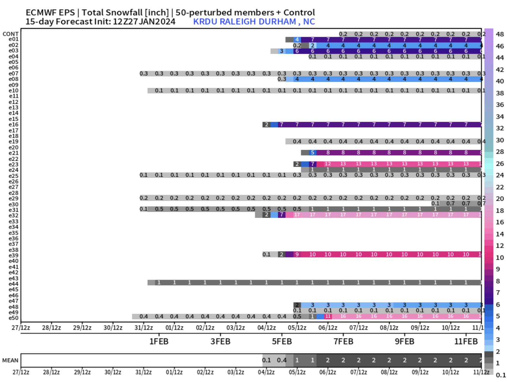
With just about 36 hours before the precip begins in the Triangle, there are a number of nagging disagreements in the modeling. Here’s where we have confidence…
Precip with spread over NC from SW to NE during the day Friday, such that we should see snow begin in the Triangle in the 4-6pm range. There could be a couple of flurries or light showers ahead of this, but the real action in Raleigh should get started as the sun sets. Precipitation will continue thru the evening and overnight. Wake County looks to be near where a transition zone will setup, mixing the snow with sleet and including some freezing rain which will produce minor glazing.
The troubling part for me is the behavior of the NAM (American short term model). It has very little snow for us, a lot of sleet and even more freezing rain. And while the NAM is supposed to be better with smaller scale vertical temperature nuances, I feel like it’s way over doing it with this warm tongue intrusion just below 850mb. It’s important to respect this possibility, and I’d like to see more corroboration from the other models as we get closer.
For now, I’d say that Raleigh gets 2″ of snow plus a layer of sleet (which will pack down the snow) followed by a thin glaze of freezing rain. All that should look like 2-3″ of a potpourri of p-types on the ground by the time we’re done.
It will be colder with more snow to the north and west, and more sleet and freezing rain to the south and east. Model trends have been toward more moisture across the NC/SC. We’ll see if that trend continues and we eek out a little more white stuff, in general.
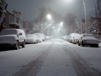
Travel conditions should go downhill tomorrow evening and then even after the precip ends early Saturday morning, it will take a while for travel conditions to improve. There will probably be a window where things thaw out on Saturday after lunch, but as soon as the sun goes down, temps will drop and a hard freeze will take us down close to 20° overnight. Lots of widespread black ice are expected on Sunday AM.


Recent Comments