« Posts by trex

A White Shamrock?

Not to hype, but… just because it’s late in the season and why not?

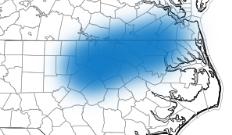
Another storm should arrive in NC on Sunday from the Gulf.  As colder air works in late Sunday into Monday, it’s possible that we could see a changeover to snow as the storm pulls northeast.  Hence…white shamrocks.  Of course, the elusive wraparound snow with the cold air chasing the moisture is in practice hard to achieve.  It’s a long way out and this would probably not end up being anything more than pretty with insufficient cold air to play with.  But I thought you’d like to know.

Go West, Young Man

Those in Raleigh hoping for more wintry weather will be disappointed it seems.  Farther west in the central and western parts of the state there is the potential for a significant winter storm.  This setup is even more complex than a normal NC winter storm with funky thermodynamics coming into play in a near-freezing environment.

For Raleigh, there may be a period of some sleet and a little glazing in the trees and elevated surfaces, but no problems on the roads for sure.  Just a lot of cold biting rain.  As you go west, there will be more significant icing before the changeover to rain.  And in the mountains the potential for a lot of heavy wet snow.

But since all of the significant winter weather will fall to our west…i get a pass on having to break this one down!  If something changes, I’ll, of course, let you know.

Meh…

A quick note to say that I’m not impressed with the winter weather potential here in the Triangle for tomorrow night/Fri.  We’re on the wrong side of marginal.  Toward Greensboro and Winston and Danville, maybe some minor issues.  In the mountains, yes.  Will continue to watch if there seems to be a trend toward colder solutions.

The Last Gasp

The back end of the precip band is within sight, but not before we get thru a couple of intense bursts of sleet and snow.  A weaker band is moving out of the Triangle now with a more intense, more convective line on it’s heels progged to arrive in Raleigh by 7.  This line has history of a couple of lighting strikes, so don’t be surprised to hear a rumble of thunder under an intense shower of sleet or perhaps snow.  The snow line is working it’s way south, entering north Raleigh at this time.  So when it all plays out, the forecast of 1/4 to 1/2″ of sleet and snow probably will pan out just fine.

The big story will continue to be the cold and with these bursts of sleet/snow the roads will become worse even more quickly.  Stay home tonight.  Schools may have to rethink a 2 hr delay as not being late enough for tomorrow.  Temp is down to 25 at WeatherTrex now.

Flash Freeze

The rain came… the cold chased.  But the cold wasn’t quick enough to get a prolonged period of accumulating sleet going before the first wave of steady precip headed east.  Some locations, north and west of the Triangle saw a little accumulation, around here just a couple of window-dressing sleet and snow showers.

What will happen from here…We’re in a lull in the precip for the next several hours (altho as I’m about to publish this…there looks to be another round of sleet/snow in the Triangle by 3:15/3:30) with just some spotty sleet and snow showers.  The concern now becomes the advancing cold air.  It has been below freezing since just after 1pm and the temperature will continue to drop into the mid 20s by the end of rush hour and to the mid teens overnight.  Once you get in the mid 20s, all the moisture leftover from this AM’s rain will quickly begin to freeze and things will become an ice rink regardless of whether we get more frozen precip this evening.

As for that additional frozen precip…We will see more showery sleet and snow episodes late afternoon into this evening.  When the precip is stronger, it’s more likely to be sleet or snow.  When it’s lighter, it’s likely to be freezing drizzle.  The only way to get any real accumulation would be under a more organized band that provided a prolonged hour or so of precip.   This would be most likely this evening and probably from the Triangle north and east.

The thing that makes this a dangerous situation isn’t really the volume of any frozen precip, but the fact the cold air rushing in now will freeze things up efficiently and quickly.  So watch out for the Flash Freeze!  Sounds like the next greatest meteorological buzzword to go around…a la Polar Vortex and Black Ice.  Ha!

Looking past tonight, Wed morning has the potential to be interesting with another nuisance event of some light freezing.

Then there’s Friday…probably just a cold dreary heavy rain, but something to watch for at least part of the area (NW) to experience heavy wet snow.

The Backdoor

In the meteorological nerd underworld, tomorrow will be a sight to behold.  To say the temperature differential across this front is steep is an understatement.  The backdoor cold front is dropping south this evening across VA.  Charlottesville dropped 20° in about 2 hours this afternoon.  It’s a little hard to imagine that we’re talking about winter weather when today was a beautiful foretaste of spring with a high of 71 and the 10pm temp still holding at 60° at RDU.

The backdoor cold front comes thru tomorrow AM with temps still near 50 at the bus stop.  Then, as we progress the rain begins and bottom falls out of the temperature floor.  The rain will changeover to sleet from north to south, which times out near lunchtime in the Triangle.  The sleet will be showery and perhaps heavy at times, before changing over to a light snow or freezing drizzle on the back end as the cold dry air takes over.  The amazing thing will be to go from waking up to 50°ish and ending up at about 25° for ‘slush hour’, I mean rush hour.  Then the cold air continues to funnel in with overnight lows in the mid teens.

Most probably, the sleet and then snow should accumulate in the Triangle to only something like 1/4 to 1/2″.  But remember sleet is more efficient at causing problems than snow.  The fact that we were so warm today obviously works in our favor for limiting accumulations.  So, there is the opportunity to dodge a bullet with lighter precipitation rates.  With lighter rates the ground has time to respond and melt the sleet.  We’ll evaluate the radar trends tomorrow AM and nowcast from there.

To reiterate, this is north/south storyline.  Closer to the VA border, the more sleet and snow.  Closer to Fayetteville, the more rain and fewer sleet pellets.  The real heart of the storm will impact central and northern VA with impressive snow totals.  Travel to DC and Baltimore will be a no go, while the NYC and Philly get just a glancing blow.

Glad I don’t have to make the early release call for the schools tomorrow!

Back on the Grid…

I’m just back from a mission trip to Costa Rica, which is why I’ve been silent on tomorrow’s winter weather event.  I have not had any time to formulate a reasonable assessment of the situation yet.  But I’m getting so many emails from many of you all that I thought I needed to put it out there why.  Give me until this evening and I will update.  What I will say now is that…it’s a very interesting situation and it looks like another no-win situation for the schools.  ugh.

Whistle Down the Wind

Squall line is entering western Wake Co. now with gusts in excess of 50 mph.  Get inside and be safe!

The Final Curtain

While there are some pockets of heavy accumulating snow, they are the exception and not the rule.  Temps are just above freezing and melting is taking place.  We will continue to see snow showers for the next several hours, but there should be very little additional accumulation…just a couple of exceptions under really vigorous cells.  Again, the summertime afternoon thunderstorm analogy is a good one…general showers with couple of gully washers embedded.  So enjoy the pretty postcard snow and be safe.  And I won’t even mention the possibility of a little snow overnight Friday 😉  Don’t worry, probably not a big deal for us (we’re probably too warm), but it may be the seed of another coastal storm for the mid-Atlantic and NorthEast for Saturday.

Have Snow Fear…

…if you get a little rain in the next hour before the heavier snow showers arrive.

Short term high resolution models are doing a good job depicting today’s snow.  Compare these:

Screen Shot 2014-02-13 at 11.14.45 AM Screen Shot 2014-02-13 at 11.14.57 AM

Careful, because the color schemes are different, but at the top are the actual reflectivities (normal color bar from a typical radar shot) and at the bottom the simulated reflectivities from a short term ‘nowcasting’ model (the precip types are color coded snow=blue, pink=sleet, green=rain)

All to say that, I’m believing in a little higher totals at this point.  Again, still the highest totals to the north and west, but the Triangle may be able to get 2-3″ generally with lollipops of 4 and 5″ under convective cells.  And several reports of  thundersnow have come in from the western part of the state.  Not out of the question here for us, either.

This next picture is of liquid equivalent QPF from that short term model on a super close-up shot centered on the Triangle (look for the county lines).  Couple of things to note:  the cellular nature of the precip distribution, and decent totals.  Here the dark green starts the .3″ contour and the dark blue is .4″, while the second blue contour is .5″ and then each contour goes up by tenths.  Bottom line is that this model depicts quite a bite of moisture.

Screen Shot 2014-02-13 at 11.03.11 AM

(also, note that if you need these images larger, you should be able to click on them to pop them out of your browser window)

Here we go!