Ok, so maybe a plan hasn’t come together, but at least we’re beginning to see convergence in model solutions.
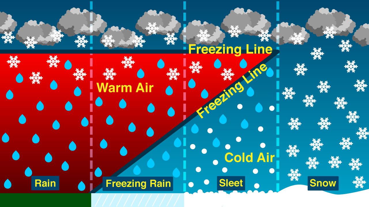
I’ve said for days that a winter weather event mid next week fits the pattern, and now the latest 12Z suite of model guidance speaks with a voice of unanimity of a more suppressed storm track and slightly quicker timing than previously depicted. These two items work in favor of a significant wintry mess. The suppressed storm track means we would be squarely on the northern side of the storm track (colder). The moisture arriving quicker would ‘lock in’ a cold air wedge at the surface from strong evaporative cooling realized by dropping moisture into the abnormally cold, dry air initially in place. As far as sensible weather…this would mean precip begins as snow, then changes to sleet, then freezing rain. More snow and sleet north and west. More sleet and freezing rain south and east. Then rain to the south and east of the freezing rain. That’s the plan. Where does the transition zone lie? If you believe today’s runs, then the Triangle would spend the majority of the event below freezing.
Only problem…it’s five days away! At this point nothing is set, but the pieces are there. We’ll see if they align.
4:57 PM, February 12, 2015Nate /
This sounds like SNOW-MA-MAYBE 2015!!!
7:33 AM, February 13, 2015Cal Naughton, Jr. /
I like that ice picture Mikie.
I also like to picture Jesus as a figure skater. He wears like a white outfit, and He does interpretive ice dances of my life’s journey.
8:02 AM, February 13, 2015Eric /
I hope this plan does come together!